Blog Archive

Wednesday, November 29, 2023

Ultimate Iceland: Studlagil, Hengifoss, and Heineberg Glacier

Leaving Akureyri, we went east, passing Lake Myvatn for the second time in two days, but this time with the sun shining. The landscape around this area is a thick layer of crumbling cooled lava covered in rich plant life. Lake Myvatn can be seen in the background. 

After that we headed to an Iceland Instagram sensation - Studlagil. This place only became visible in 2007, after a dam was built upstream. It only became a tourist destination in 2017, when it appeared in a brochure for an Icelandic airline. This place is featured extensively in A Murder at the End of the World, Season 1, Episode 4, which was released about six weeks after we came back from our trip. The actors walk in exactly the same spot we walked in, on the left side. 

We even took a selfie exactly where they stood on the show. I look like a lunatic with the wind blowing my hair. All part of the adventure!

These basalt columns are formed when magma cools rapidly as it forces its way up through millions of tons of glacial ice to reach the surface. This causes the liquid basalt to crystallize into hexagonal columns. 

The columns look so flat-sided and regular as to appear man-made, but they're natural. 

Since Iceland is full of both volcanoes and glaciers, columns like this appear in many places.  

In fact, basalt columns are the inspiration for the design of the famous Hallgrimur Church in Reykjavik. The vertical columns in the facade of the building are also hexagonal. 

The next day, we hiked a mile and a half up to the tall, slender waterfall Hengifoss. On the way up, we passed a beautiful, smaller waterfall fed by Hengifoss. Basalt columns formed here too. It almost looks like someone placed planters on top of each column. 

The official trail up to Hengifoss ends about a quarter mile short of where the falls actually touch down. At this point, the falls look like this. Notice the young woman posing while a drone films her from just above and behind her head. The drone is visible as a white spot in the highest resolution version of this photo. 

To get there, we had to scramble on rocks to cross the stream, then clamber up more gritty, wet rocks. You see easily the layers of different types of rock formed over millions of years, alternating black, red, and yellow.  

It was really exciting to watch the water fall hundreds of feet, crash into the rocks, and splash in the green pool at the bottom. We could feel the cool spray and brisk wind created by the falling water on our faces.  

Hiking back down on the other side of the stream, we got a view of another tall, thin waterfall named Litlanesfoss.   

The next day, we headed out to a nearby eastern fjord called Mjoifjordur, which means narrow fjord. There are no tourist attractions there, and the road is gravel the entire way, so very few people go out there. I wanted to go see a series of waterfalls there, but I ended up really enjoying the whole drive. Here's a waterfall I saw from the road and went to take photos of.  

All of the rocks there are completely carpeted in a six-inch thick layer of spongy green, yellow, and orange mosses. This is a wonderland that can never be a tourist attraction, as too many tourists would destroy it just by walking on the thick moss. 

The views as we came over the head of the valley and looked out over the fjord were gorgeous. 

For those last two nights, we stayed in Eglisstadir, the biggest town in east Iceland, with a population of under 3000. The next day we headed down the eastern coast and started heading west along the southern coast. Here is a series of nameless waterfalls on private land that we passed as we drove south on a chilly, rainy morning. 

I had been hoping to get close to the face of a glacier on this drive, so I looked on the map and said let's turn north here, where a road headed toward the glacier. To get to this glacier lagoon, we were again driving on gravel roads, and then on a sort of rocky riverbed, for several miles. It got a little hazardous, as water had created some drop-offs Jennifer had to navigate around. 

We decided to walk around the edge of the lagoon toward the front of the glacier, which was further away than it first seemed. Looking back toward the terminal moraine (the large mound of gravel left at the front of a glacier's advance). There's Jennifer on the right.

As we hiked around the lagoon, we had to climb higher up. The lagoon was surrounded by cliffs looking down on the water. 

The icebergs in the lagoon are pieces of the glacier that broke off and rolled onto their sides. We walked for close to an hour and still weren't all that close to the face of the glacier.  

The black stripes in the blueish white ice are caused by ash from different volcanic eruptions over the last several hundred or maybe several thousand, years. So, the layers are snow and ice, then ash, then more ice, and so on. 

That's it for this edition of Vick and Jennifer's Icelandic Travels. Still more to come though! 

Click here to see the first couple days of the trip, with Icelandic horses, Arnarstapi Cliffs, and the incredible Dynjandi waterfall of the Westfjords.

Click here to see the next few days of the trip, with Arctic foxes and two more iconic Icelandic waterfalls - Godafoss and Dettifoss. 


Wednesday, November 15, 2023

Ultimate Iceland: Westfjords to Godafoss and Dettifoss

The photos in this article cover a huge distance, from Isafjordur, in the northern Westfjords, across the north of Iceland to the Godafoss and Dettifoss waterfalls. After spending the night in the northern port town of Isafjordur, which means something like ice fjord town, we headed south again, along a road which followed the zigzagging contours of one fjord after another. It was cool and cloudy, but no rain. 

We were happy to see that the Arctic Fox Center was still open. It usually closes at the end of August, but it was Sep 4 and they were still open. The "Center" is actually a small house with a couple of nice exhibits, a beautifully done documentary, and a fenced yard in the back with two arctic foxes. The foxes were rescued after being shot by farmers who fear foxes kill lambs. 


Continuing south, the views of the fjords were wonderful. We stopped to take a look at this sturdy little shed. It looked abandoned. Many areas in Iceland have this rich, thick, thigh-high green grass. 


The shed from the photo above is actually in the photo below, taken after driving twenty more minutes. The shed is along the coastline just to the right of the central peak and the inlet.  You'd need to look at this on your big TV to be able to see it. The wind was blowing pretty hard, which you can sort of see on the surface of the water. 


The wind was some of the strongest we encountered during the trip here. The water is covered in whitecaps. The rental car companies warn everyone to hold onto car doors when opening them, as the wind can catch it and bend it backwards. When I went to get back into the car here, I held onto the door as I opened it and the door pulled me along with it. Almost pulled me over. 


On our way down the coast, these guys were hanging out on the road. The other sheep had already run off the sides of the road by the time we approached. These two were bold and curious. Yet again, sheep in Iceland looking freshly primped and blow-dried. When driving around Iceland, do keep an eye out for sheep. There are a lot of barbed wire fences, so I'm not sure why so many sheep are running loose. Our hosts the night before told us there is a big roundup in late fall, where all the sheep are tracked down and sorted out so their owners can house and feed them over the winter. 


This was later that day as we approached the Malarhorn Guesthouse. Iceland's stormy weather makes for beautiful skies. 


After we checked into the guesthouse, we walked down the shore, past faded blue plastic fishing nets, rusting boat engine parts, and abandoned white fiberglass hulls. Around the bend and up a hill, we found this lovely cove of crystal clear water. Oddly, there were a lot of desiccated frog bodies strewn along the trail and lying in the tall grass. My guess was that seabirds were catching them and eating them, but we never really found out. There's a bright orange lighthouse on top of the far island in the photo - just a tiny speck you won't be able to see on a phone. 


After dinner, we drove back to a great vantage point along the coast to check out the sunset. While the wind howled around the car, we ate our dessert and watched the clouds shift and the sunlight change shades. We were all alone there. I loved all the layers of clouds, from the dark ones practically touching the hills to the ones way up in the stratosphere catching the last rays of the sun.
 

The next day, we continued our drive across the top of Iceland to reach the second largest Icelandic city - Akureyri. We saw this island, and more great clouds, along the way. I couldn't see any part of the edge of this island that is NOT a cliff. I wonder if you can even get onto it. 

With just another hour to go before arriving into Akureyri, a bit north of the town called Dalvik, we stopped off to take a look from the top of a tall cliff with a small waterfall tumbling into midair and down to the water. We ended up doing an impromptu, death-defying hike along a steep hillside to get to the top of that waterfall. This is the view looking back toward where we started. It was beautiful and we were the only people there. There are three seagulls soaring in front of the cliffs. 

Unfortunately, after risking death to get to the waterfall, we couldn't see it at all - it was below us, over the edge of a 150' cliff.  Out of desperation, I lay on my stomach and reached out to try to see over the edge. 

This is what it looked like lying on my stomach and holding the camera facing downwards at the edge of the small waterfall we came to see. Years and years of moisture and cold allowed a thick carpet of moss to grow on the boulder just over the edge. 

The next day, it was raining from the moment we got up. We were on our way to see two of the biggest waterfalls in Iceland, Godafoss and Dettifoss. As you may have guessed, "foss" means waterfall in Icelandic. It was cold and rainy and windy as we walked the paths around Godafoss. I was impressed by the number of people out braving the weather. You have to expect some bad weather when visiting Iceland. In the black and white photo below, you can see a couple of people in the upper left, which helps with scale. 

Next, we drove up to Dettifoss, which is a thundering waterfall in a canyon, surrounded by nearly barren rocky flats. The falls throw spray high into the air, almost hiding themselves. 

In the photo below, you can see the river fed by the falls, flowing out of the canyon on the left.


Here's a short video that gives some idea of the power of the falls.


That's the end of the second leg of the trip. More coming soon. 

Click here to see photos from the third leg of the trip, including Studlagil, Hengifoss, Litlanesfoss, and Heineberg Glacier Lagoon. 

Monday, November 6, 2023

Ultimate Iceland: Horses, Cliffs, and Dynjandi

The icy wind nearly knocked us down as we got off the plane early on the morning of September 3 in Iceland. The day before, high winds had forced Iceland Air to cancel flights. With the wind whipping our hair in our faces, I really started to doubt my choice of time of year. But, I wanted to go on the shoulder season, between the peak summer months of midnight sun and too many tourists, and the freezing winter months when it's dark all day. At this time of year, there are fewer tourists, the days are still long, yet you still have a chance to see the Aurora Borealis. I call our trip "Ultimate Iceland" because it was two full weeks, and we covered not only the entire "Ring Road", but also went to the ends of western, northern, and eastern peninsulas, and to the edges of the Westfjords. In other words we went far beyond the Ring Road in all directions. It was great. 

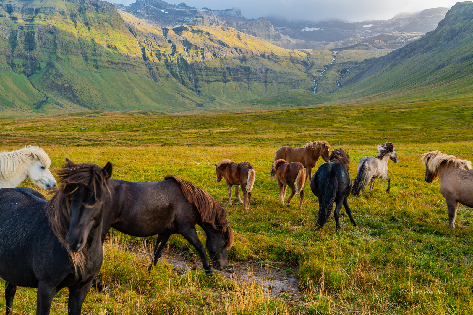
As soon as we arrived, we got our rental car and started our first day of marathon driving, bypassing Reykjavik, heading up to the Snaefelssness Peninsula. Just north of Reykjavik, we started to see beautiful horses in brilliant green pastures everywhere. The advantage of planning your own trip is you can stop wherever there's something cool to see. This is especially great for a photographer like me. 

As you can see, there are quite a few amazing breeds of Icelandic horses. Each color combination here is a different breed. Icelandic horses have been isolated from other horses for about a thousand years now. The Norse brought over horses sometime in the late 800's or early 900's. Soon after, the Icelandic government banned the import of other types of horses. They're somewhat smaller than horses Americans are used to, but plenty large and strong enough to ride long distances on difficult terrain. 


We drove all the way to the end of the Snaefellsness Peninsula to see the cliffs and the ocean there. On the way, we saw a few people walking beside a stream leading out of a mountainside, so we decided to check it out. A short hike up a hill led into a dark and narrow grotto that the stream had cut into the cliff. Every surface was covered in thick, rich, green moss. Apparently, the wet and cold environment of Iceland is perfect for this moss, because you find it in many far-flung regions of the island.


The Arnarstapi Cliffs at the western end of the peninsula were our excuse to go exploring in this general direction. We spent a little over an hour walking on (and off) the paths around the area. When we arrived there was a group of a couple hundred Chinese tourists all wearing bright red parkas included with their tour. In this first photo, the water is rushing out from this inlet bordered by a thick layer of dark brown seaweed clinging to the rocks at the waterline. The rock is crystallized basalt, which gives it the appearance of being man-made, like giant Lego rocks. Rock like this occurs all over Iceland, and comes from magma pushing up through a glacier, and consequently being cooled extremely rapidly. 


Those winds we'd encountered at the airport that morning, and that were blowing waterfalls backwards up cliffs, were still whipping up the sea - sending this wave all the way to the top of this forty foot cliff. 

Iceland, Arnarstapi cliffs, Snaefellsness, basalt, basalt cliffs, ocean, waves, nature, wilderness

Just a little while later, we got hit by a sudden, powerful hailstorm, with fifty mile per hour winds. Luckily, we just happened to be near our car, so we were able to use if for shelter. Others weren't so lucky. It only lasted five minutes, but left the roads covered in a rapidly melting layer of white hail slush. 


Our destination that night was an isolated converted farm house down 40 miles of a packed gravel road, on the northern side of the peninsula, called the Drangar Country Guesthouse. In order to get there, we had to cross over to the northern side of the peninsula. Once on the northern side, we walked on a black sand beach and watched the wavetops being blown backwards by those powerful southerly winds.

Iceland, Snaefellsness, Arctic ocean, waves, wind, sea, mountains, clouds, sunset


On the way there, we spotted a couple more horses at the outlet of an incredibly beautiful valley, with giant waterfalls at its head, and sunlight illuminating the mountains through a gap in the dark clouds.  While I was taking photos of these two horses, we noticed a small herd of horses in the distance, and they were running down from the hills right toward us. Within a minute they had arrived and run in a small circle right up to the fence and stopped there. They were bored and curious and we were their entertainment. 

Iceland, Icelandic horses, valley, waterfall, breeds, mane, hair, beautiful, nature, wilderness, adventure

Here's a video Jennifer took while I was busy trying to take the photo above.


After a great breakfast at the guesthouse, we headed northwest toward the Dynjandi waterfall in the remote region few visitors get to known as the Westfjords. One of the great pleasures of traveling across Iceland is seeing one beautiful, unspoiled fjord after another, even if it's in cloudy or rainy weather.

Iceland, fjord, arctic, mountains, clouds, tundra

That day, we could usually see bright sunlight, dark clouds, and rain all at the same time. This photo was taken from the top of a pass leading into the Westfjords, on a black gravel road that was under construction. We were driving on gravel roads for hours that day. I was surprised to find that we could do 80 KPH (49 MPH) on these roads, partly because of the 4WD we had been advised to rent. 

Iceland, fjord, tundra, moss, lichen, mountains, water, nature, adventure, travel

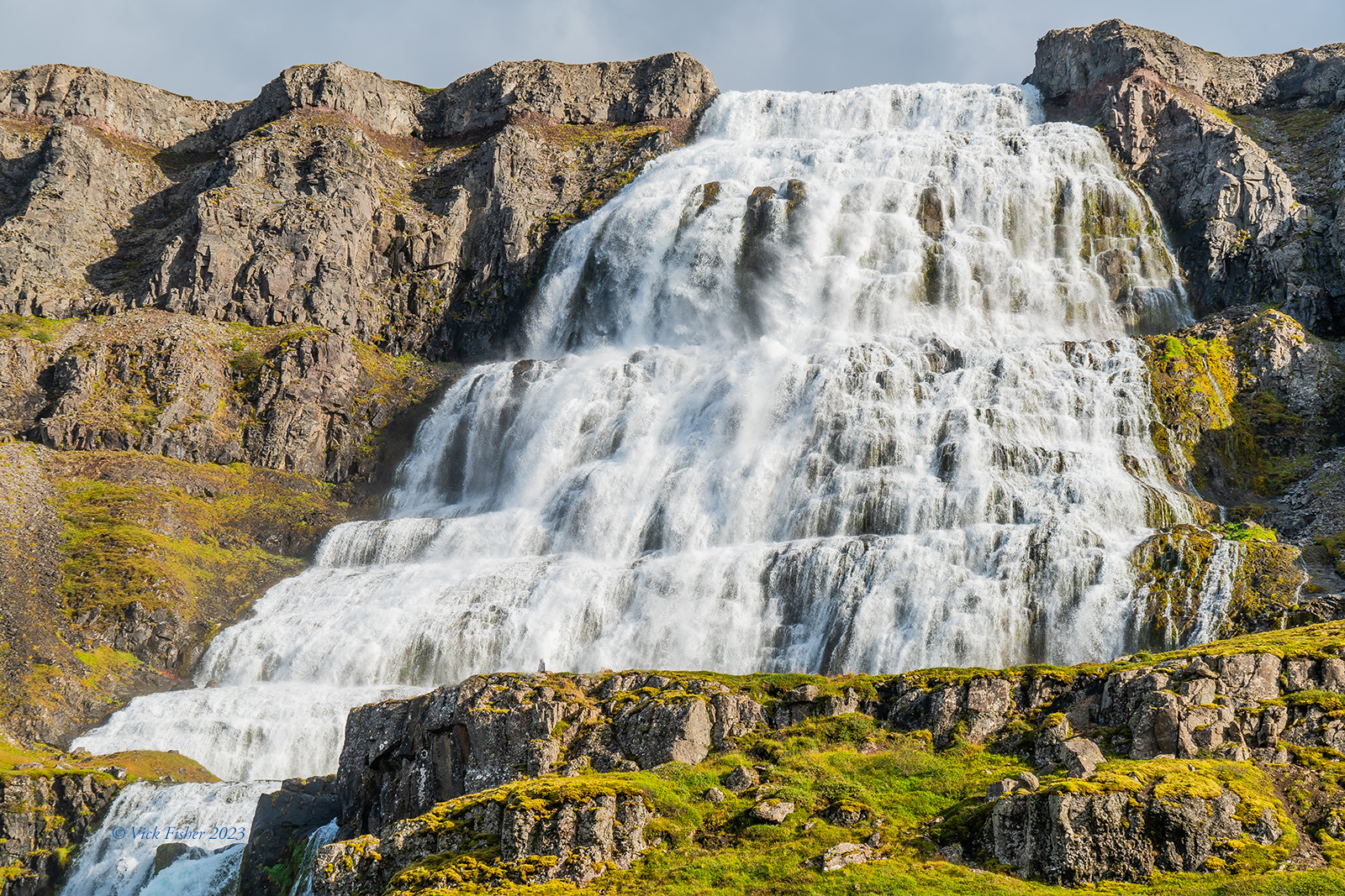
Finally, we reached the Dynjandi falls when the sun was out. There are actually several waterfalls that follow the big one at the top. This is one of the small waterfalls below the main waterfall. 

Iceland, Westfjords, Dynjandi, waterfall, rainbow, emerald water, mountains, stream, nature, travel, adventure, wilderness, beautiful


This is a view of the big one from a distance back. There's a person at the base of the falls, along the ridge, a little to the left of center. The person looks like a small grey bump because the falls are so huge. The waterfall is over three hundred feet high, so a person is pretty small in comparison. 

Iceland, Westfjords, Dynjandi, waterfall, rainbow, emerald water, mountains, stream, nature, travel, adventure, wilderness, beautiful

The water is pure and beautiful close up. 

Iceland, Westfjords, Dynjandi, waterfall, rainbow, emerald water, mountains, stream, nature, travel, adventure, wilderness, beautiful

Here's a view looking up at the falls from below.  Of course, a tripod is needed for a photo like this so the water can flow while the shutter is open for one or two seconds. My camera was getting wet, as the air was full of the spray of so many falling streams colliding with one rocky shelf after another. 

Iceland, Westfjords, Dynjandi, waterfall, rainbow, emerald water, mountains, stream, nature, travel, adventure, wilderness, beautiful

One of the most unusual parts of this day of travel is that we were driving on packed gravel roads. We were going into a remote part of the country that even most Icelanders never go to. So, the roads that go there aren't the greatest. They'll probably pave them in the next five to ten years, but they haven't gotten there yet. With a mid-sized four wheel drive SUV, we were able to drive on those roads at 40-45 MPH, which isn't that much below the national maximum speed limit of 55. To add a bit of humor, take a look at the view of our black SUV in the hotel parking lot when we arrived. I got a napkin and wiped off the license plate next time we drove it. As you can see, it was completely coated in mud.


That's all for the first leg of the trip.  


Popular Posts